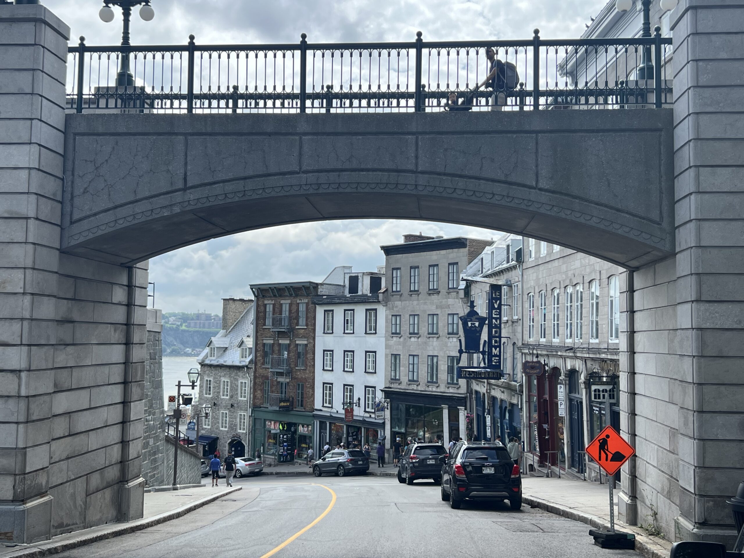
Côte de la Montagne is one of the principal historic routes between Quebec City’s Upper Town and Lower Town. The steep street begins near the river-level old town and climbs toward the fortified heights, making the city’s geography visible in a few minutes of walking.
Why the street matters
The cliff and promontory shaped Quebec City from the beginning. Upper Town offered a defensible position for government, military and religious institutions, while Lower Town developed around the port and commerce. Côte de la Montagne became a practical connection between those levels.
Walking it today gives more context than treating Upper and Lower Town as separate attractions. The change in elevation explains street alignments, sightlines and the city’s long-standing transportation challenges.
What you will see
The route passes historic masonry buildings and offers changing views toward Lower Town. Near its lower section, it connects with the Breakneck Stairs—Escalier Casse-Cou—and the Petit-Champlain area. At the upper end, the streets lead toward Place d’Armes, Dufferin Terrace and the Château Frontenac.
Walking direction
Descending from Upper Town is easier on the legs and brings you toward Petit-Champlain and Place Royale. Climbing from Lower Town makes the top feel more rewarding but is a short, steep workout. Either direction works well as part of a loop rather than an out-and-back walk.
Accessibility and winter conditions
The grade and nearby staircases can be difficult for travellers with limited mobility. Sidewalk width and surfaces vary, and snow or ice can make the route more demanding in winter. The Old Quebec funicular provides an alternative connection between Dufferin Terrace and Lower Town; check its current operation before relying on it.
How long to allow
The street itself is short, but a useful walk takes longer than the distance suggests. Allow about 20 to 30 minutes when moving downhill and stopping for views, more if you explore the connecting stairways and lanes. Uphill walking, winter footing, crowds and photography can all extend the time.
Do not schedule the climb as a tight connection to a timed attraction. The pleasure comes from reading the slope and surrounding buildings, not from reaching the other end as quickly as possible.
A practical loop
From Upper Town, begin near Place d’Armes, follow Côte de la Montagne toward Lower Town, then continue to Place Royale and Petit-Champlain. Return via the funicular if it is operating, or climb the Breakneck Stairs and connecting streets if everyone in the group is comfortable with steps. Reversing the loop gives you the climb first and a flatter finish around Dufferin Terrace.
Photography and crowd timing
The angled street, stone walls and changes in elevation create layered views, but this remains an active public route. Stand clear of doorways, driveways and narrow pedestrian space. Early morning generally provides more room than midday, while winter light and holiday decorations can make the scene attractive at busier times.
Rain, wet leaves and packed snow can make the grade slippery. Use footwear with grip and keep cameras or phones secured so you have a free hand where needed.
Where to pause
Use wider corners and designated public spaces for a longer stop rather than blocking the narrowest part of the route. Looking back every few minutes reveals how the cliff, rooftops and river-level streets align. The view changes more than the short distance suggests.
How it fits into an Old Quebec visit
Combine Côte de la Montagne with Dufferin Terrace, Place Royale and rue du Petit-Champlain. Allow time to stop rather than treating it only as a passageway—the street is most useful when you notice how the city changes with elevation.
See our guide to Quebec City versus Old Quebec for the larger geographic picture, and consult Destination Québec cité’s Old Quebec guide for current visitor planning.
Discover more from Quebec City 101
Subscribe to get the latest posts sent to your email.